First of all, let me acknowledge that Public Transport from the Nokia Maps Suite has been available for some time now.
Also, since about 5 years it was possible for me to already look like a native when walking in new cities, using Nokia Maps’ ‘walk’ mode. That thing worked pretty well by putting my N85 in my pocket after inspecting the overall route, and then turning left and right at each new vibration. (As a rant, today’s phone don’t have that kind of powerful vibrator to actually use buzz-guided walk navigation from your pocket, you would still have to hold your hand on the phone in your jacket..)
Adding public transportation to beeps-and-buzzes guided walk means that you look even more like a native when you’re not staring at maps when at subway or in stations for surface transport.
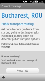
Now this is the new support for Bucharest I was talking about:
If you’ve already been to Bucharest – or you’re living there, for that matter – probably there is no surprise for you that the support is not quite one of the top: there is estimated journey time (with data from Metrorex and RATB – no ‘Cora’ or ‘Real’ supermarket buses:P) but no actual schedules.
This is not a flaw with the application however. There are no real schedules in reality either. Or if they are, they are not respected, partly due to the kind of traffic we get but mostly for unknown reasons.
Now for planning a journey: I set the starting location as … ‘My location’ and the destination the workplace, so I could get the commute time.
It gives me two options: either take the subway, or mix the subway with terrestrial (tramway) transport. Both of the options are correctly accompanied by some walk needed to get to it and then to get to the final destination.
What’s interesting is that there’s no walk in the alternative route between the subway and the tramway, which actually corresponds to the reality (the stations are in the same place as much as the subway vs. surface allows).
It says ~50 minutes for the first option, which roughly corresponds to what I have witnessed.

Now on to selecting the first options, we have the three segments detailed in a vertical fashion: 12 mins walk, 26 mins subway, 12 mins walk (left picture).
Unfortunately this does not take into account the time for the actual train to get into station, as stated above, because no one really knows.

Now, if you click each of the segments, you get even more usefulness: starting with the subway trip, you get the list of stations you are reaching in your way from Nicolae Grigorescu to Lujerului (taking the train in Preciziei direction).
(see right image)
If however you click one of the ‘walk’ segments, you get the beeps-and-buzzes walk mode navigation mentioned above from your current position to the next station in your trip.

And of course, if you haven’t been living under a rock for the last 5 or so years, you get the option of voice-guided navigation on every Nokia phone since 2007 (for free since 2009) if you would ever choose to commute by using a car.
In this case, using a car gives you a ~40 minutes estimation if you take traffic into account (Traffic however is the next thing I wish Nokia should make available for Bucharest).
Not pictured in the below image, but these are 13 kms.
So yeah, can’t wait to see how this goes when you’re actually in a foreign country and an unknown city! (Altough I can now still test it in Bucharest since it has become available, because for other destinations I could’ve aready tested if I were visiting, y’know).
What can I say? Keep the updates coming, Nokia!


